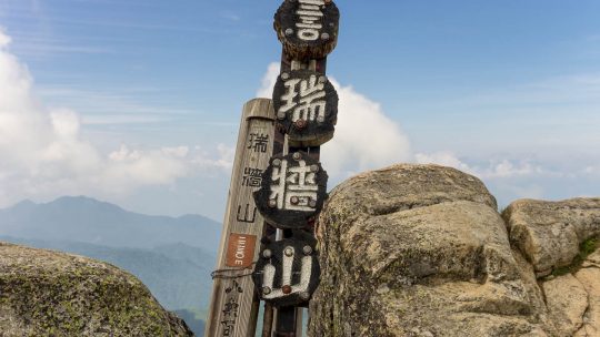
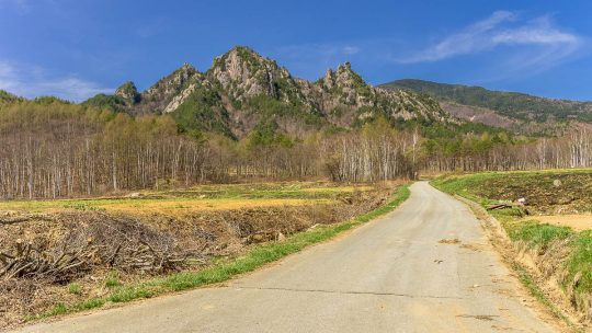
Hiked on Jul 31, 2014 Aug 23, 2023 . Mizugaki-sansou 瑞牆山荘 – Mt. Mizugaki 瑞牆山 Duration: 5.5 hours Distance: 5.9 km Elevation change: 720 metres Highest point: 2230 metres Start: Mizugaki-sansou ...
David grew up in the eastern suburbs of Melbourne, Australia, with hiking and outdoor pursuits being a major part of his life for as long as he can remember. He has been writing, snapping photos, and sharing his adventures on RIDGELINEIMAGES.com since 2013.
At university, David majored in environmental management and holds a Graduate Diploma of Education. He has been living in Japan for over 15 years, first in Fukushima Prefecture and now in the Tokyo Metropolis. With a love of hiking and photography, he felt the best way to combine the two was a blog to provide some inspiration for others to enjoy the myriad of trails and outdoor offerings on Tokyo’s doorstep. You can follow David on Instagram @ridgelineimages.
Hiked on Jul 31, 2014 Aug 23, 2023 . Mizugaki-sansou 瑞牆山荘 – Mt. Mizugaki 瑞牆山 Duration: 5.5 hours Distance: 5.9 km Elevation change: 720 metres Highest point: 2230 metres Start: Mizugaki-sansou ...

Say Farewell to Blisters with Tegaderm Foot blisters out on the trail are more than just a nuisance and have in a worse case scenario the potential to ruin a hike. I have previously written about the importance of looking after your feet through the...
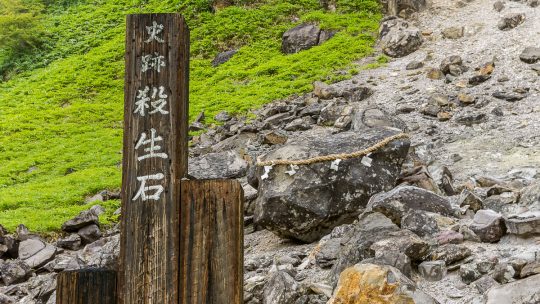
Legend of the Sesshoseki Murder Stone On March 5, 2022, it was reported that the stone had split into two parts most likely a result of natural weathering. Our second day in Nasushiobara was spent around the Nasu Onsen hot spring resort situated...
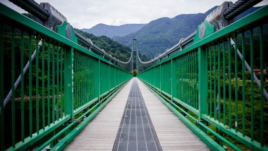
Longest Suspension Bridge in Nasushiobara Located a 70 minute shinkansen ride from Tokyo the popular tourist spot of Nasushiobara is a picturesque region in Tochigi Prefecture. The city has two main hot spring towns namely Nasu Onsen and Shiobara...
Hiked on Aug 4, 2013 Aug 23, 2023 . Mt. Kobutaka コブタカ山 – Mt. Honita 本仁田山 Duration: 4.5 hours Distance: 7.7 km Elevation change: 914 metres Highest point: 1224 metres Start: Hatonosu station (JR Ome...
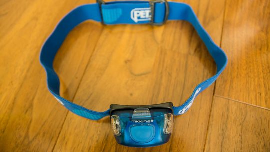
Petzl Tikkina 2 headlamp Designed for Everyday Lighting Needs With dusk quickly approaching you set up camp and start preparing dinner only to find that your trusty headlamp has been blissfully illuminating the inners of your pack all day. With your...
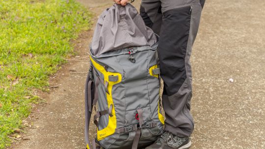
Mammut Trion Pro a Technical Alpine Backpack from Mammut The previous backpack I used for day hikes was Australian made and provided many years of loyal service. However as with all good things it was a broken zipper which finally sent it into...
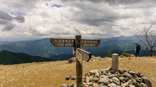
Hiked on May 22, 2014 Aug 23, 2023 . Mt. Takanosu 鷹ノ巣山 – Mt. Kayanoki 榧ノ木山 – Mt. Kurato 倉戸山 The Inamuraiwa Ridge remains closed due to collapses in several places. For the latest information please refer to the Okutama Visitor...
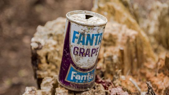
Old Steel Fanta Cans Masquerading as Archaeological Scrap While Japan on the whole takes enormous pride in disposing of rubbish thoughtfully particularly in the urban environs, some mountains with Mt. Fuji being a prime example, still haven’t...
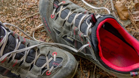
A Solid All-Round Trail Shoe from Mammut The Mammut Redburn GTX have undergone several minor revisions since their release in 2008 with the shoes earning a strong following amongst outdoor enthusiasts. The Redburn GTX are often referred to as an...
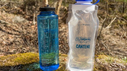
A Versatile Collapsible Water Bottle from Nalgene It goes without saying, that a durable and more importantly leakproof water bottle is an absolute must when venturing into the backcountry and over the years I have tried many of them. For a long...
Hiked on May 1, 2014 Aug 23, 2023 . Kawahake 川端下 – Kinpo sansou 金峰山荘 Duration: 3 days Distance: 17.5 km Elevation change: 509 metres Highest point: 2048 metres Start: Kawahake Bus Stop Finish:...