.
Ogouchi Dam 小河内ダム – Yama-no-furusatomura 山のふるさと村
Distance: 17.9 km
Elevation change: 30 metres
Highest point: 565 metres
Start: Lake Okutama Bus Stop
Finish: Miyama-bashi Bus Stop
Difficulty: ▅▅▅▅▅▅▅▅▅▅ ❷
Map: Yama to Kogen Chizu 山と高原地図 [No.25 奥多摩 OKUTAMA]
GPX TrackKML TrackGSI MAPPDF Topo Map
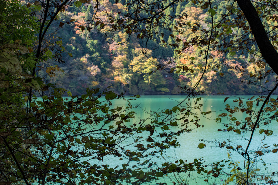
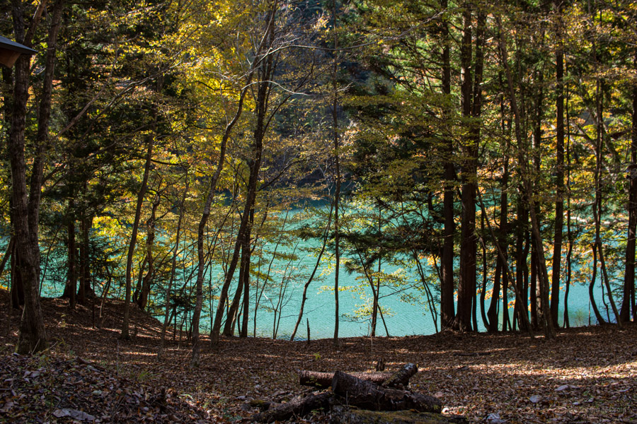
Wandering the Gentle Shores of Lake Okutama
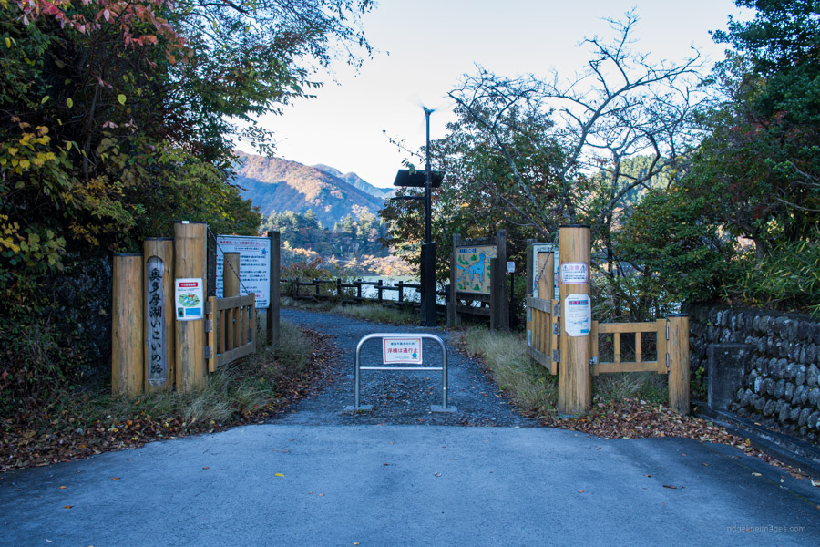
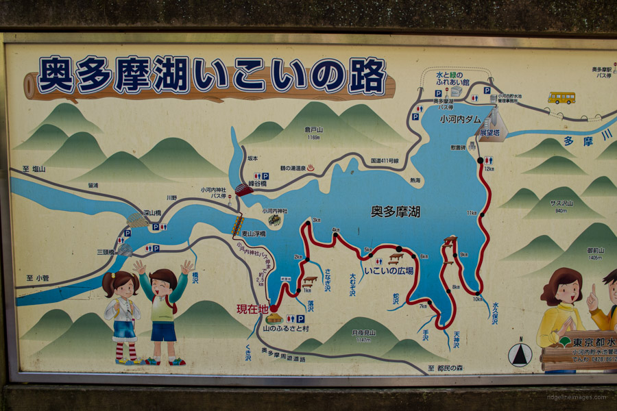
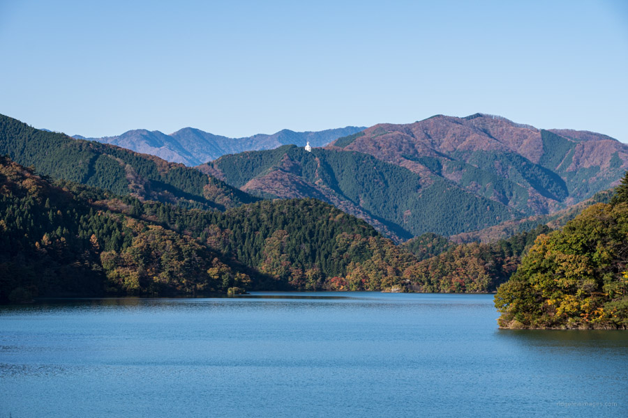
The Okoi-no-michi 奥多摩湖いこいの路 is a 12 km mostly flat walking path that winds around the banks of Lake Okutama in western-most Tokyo. The trail stretches from the Ogouchi Dam to the Yama-no-furusato-mura a Tokyo metropolitan natural park. The trail opened in April 2007 and is ostensibly a continuation of the Okutama Mukashi Michi. Fit and fast hikers could foreseeably combine them into one massive, long day hike. Note the trail is closed in winter from December 1st to the 2nd Thursday of April and at other times in the event of heavy rain.
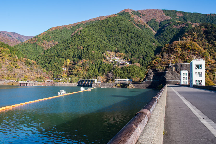
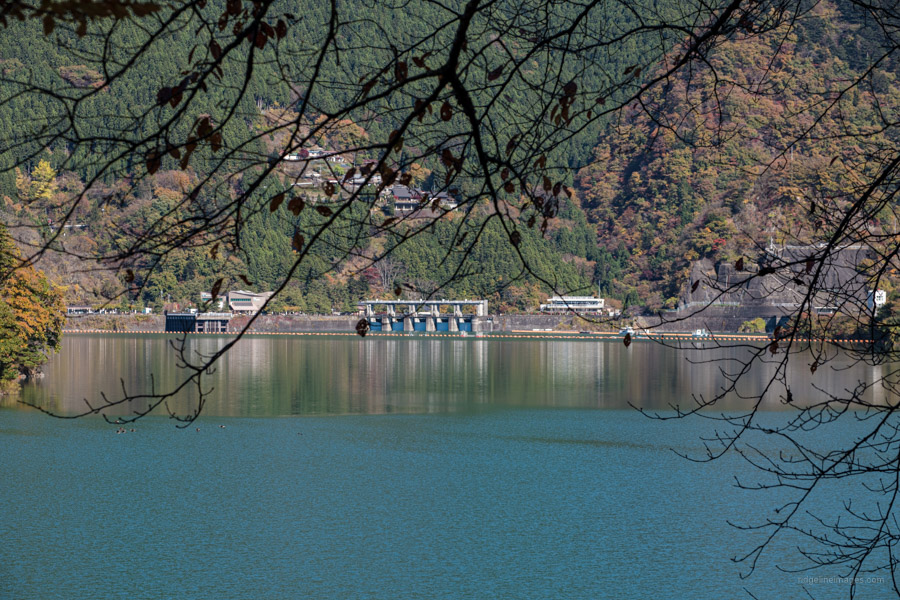
The Ogouchi Dam which marks the start of the trail is a 15-minute bus trip (360 yen) from Okutama Station. From the Okutama-ko Bus Stop walk across the top of the 185,400 megalitre dam which was completed in 1957 and remains instrumental in safeguarding Tokyo’s water supply. For more information about the colossal effort that went into constructing the Dam check this blog post. At the far side of the dam wall there is a cenotaph which honours the 87 workers who lost their lives in the process of construction as well as the entrance of the Okoi-no-michi.
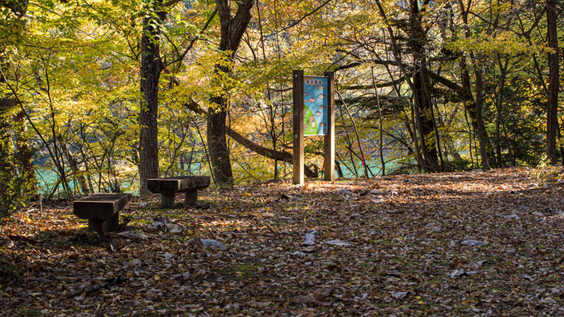
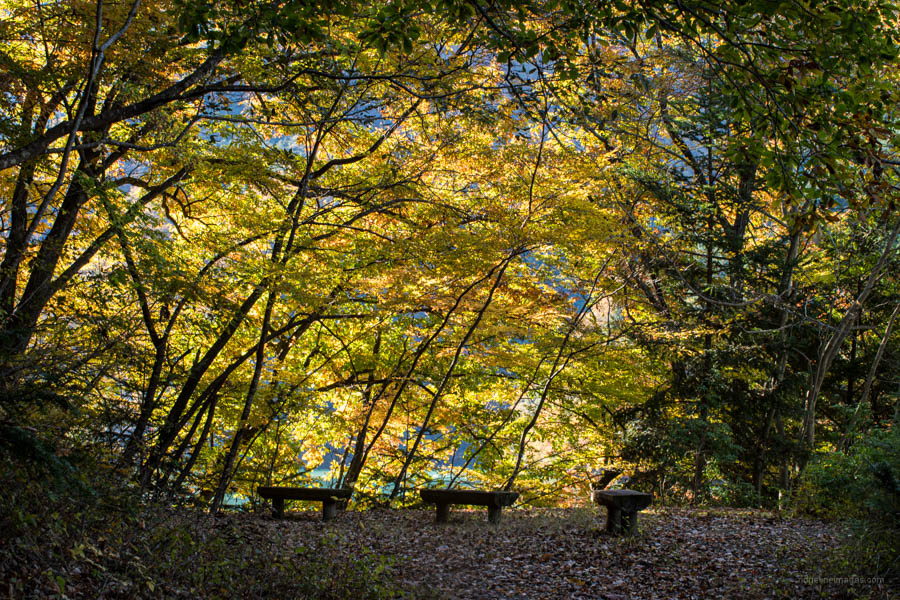
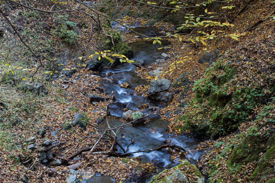
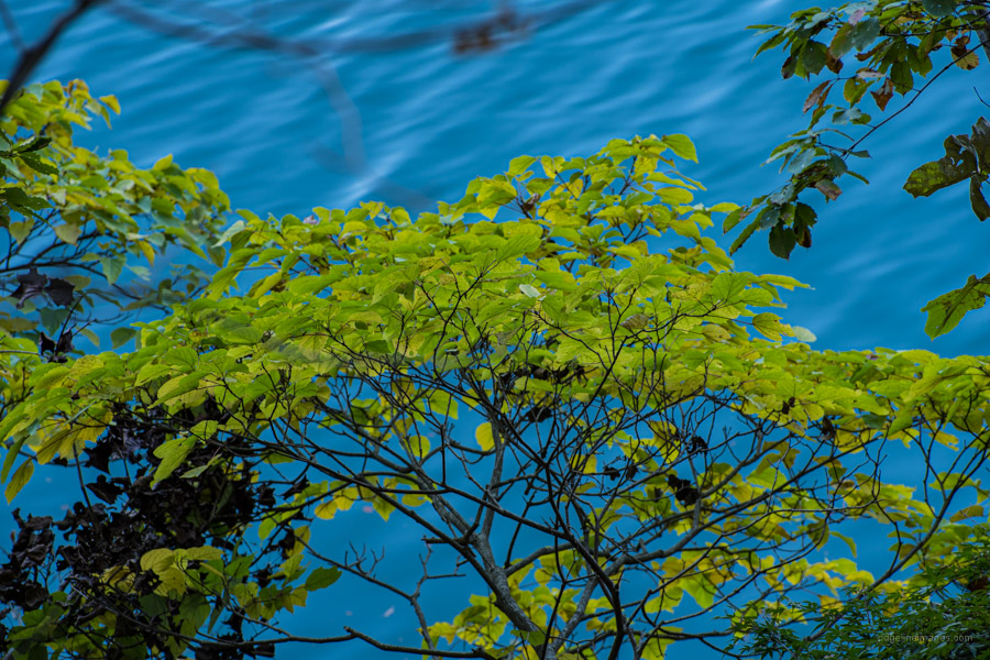
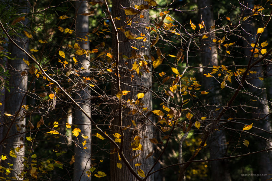
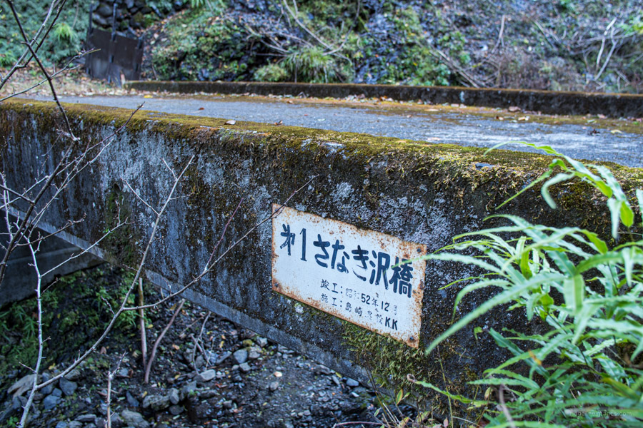
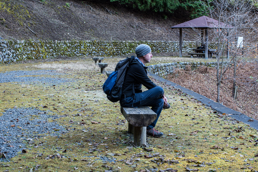
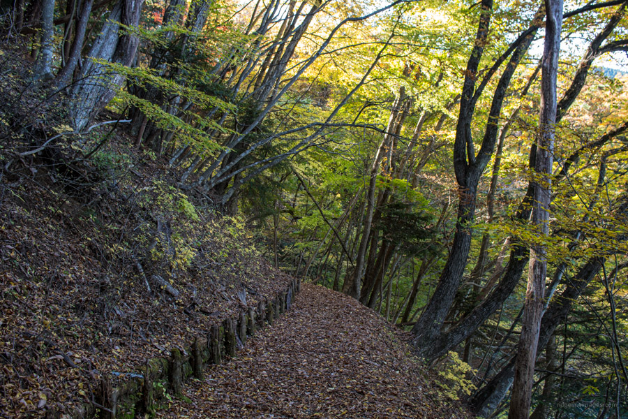
The first two kilometres follows a graded forestry road before narrowing to a walking path as it weaves deep into the inlets of the lake. The surrounding forest here is home to a large troop of Japanese macaques Nihonzaru. While there are no particular hazards the trail has a fair amount of leaf litter hiding rocks, which could easily twist an ankle. Numerous sheltered rest spots are dotted along the route and information boards draw attention to the local flora and fauna. Distance signposts are installed at 200 metre intervals making it easy to gauge your pace.
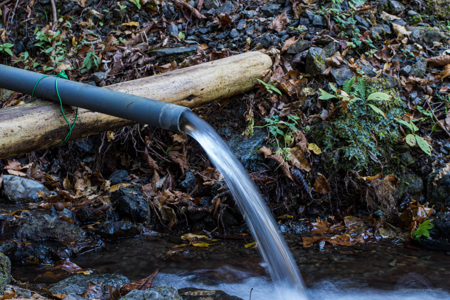
Just before you reach Ikoi-no-Hiroba around the midway point which has a restroom there is a water hole and one final view of the dam wall before you begin to track more westerly. From this point forward one minor nuisance worth mentioning is the noise created by motorcycle speed demons up on the Okutama Shuyu Doro thinking their Valentino Rossi.
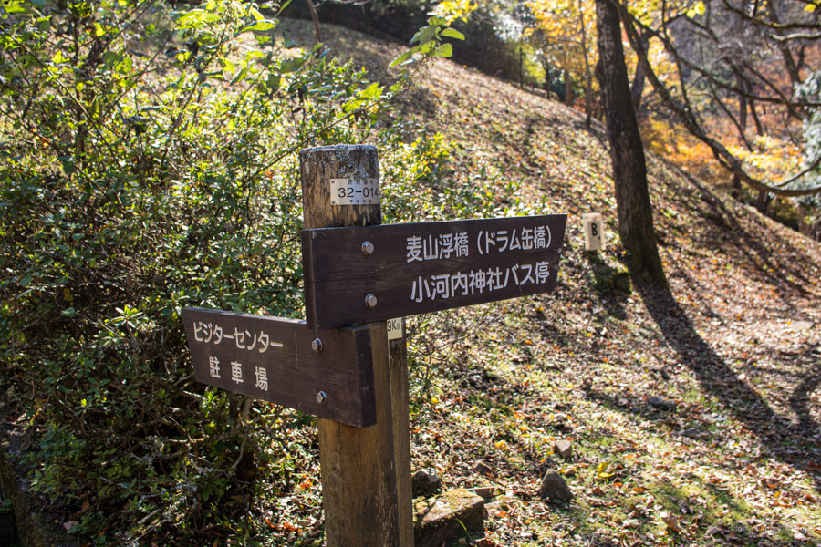
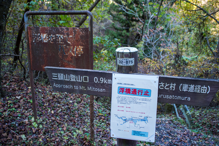
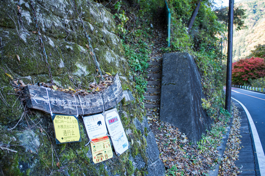
A good place to take lunch is a picturesque rest spot just after the 10 km signpost and was the only time I passed hikers heading in the opposite direction. A little further on finds the Yama-no-furusato-mura 山のふるさと村 which maintains an information center and the Yama no Furusato Village Campground. This also marks the official end of the path. To get to the Mugiyama-Ukihashi (floating bridge) 麦山の浮橋 and Ogouchi-jinja bus stop continue for 2.5 km along the Kohan-no-komichi and a further 2.5 km after that following the Okutama Shuyu Doro to reach the Miyama-bashi bus stop 深山橋 for the return trip to Okutama Station (30 mins, 590 yen). You can check the current status of the floating bridge here: 奥多摩ビジターセンター #麦山の浮橋
If the bridge is available it’s worth calling by the Ogouchi Shrine which memorialises the nine shrines from the former village. If you’re continuing to the Miyama Bridge, you’ll pass the Mt. Mito trailhead and walk under a support pylon and cable lines which once drove the Okutama Ropeway. Finally, just before crossing the bridge there is popular soba restaurant overlooking the lake.


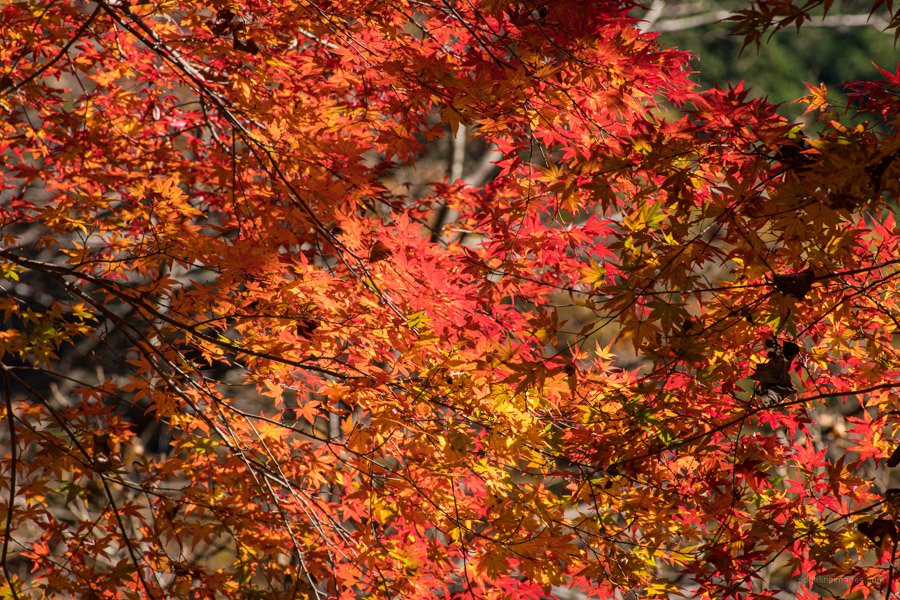

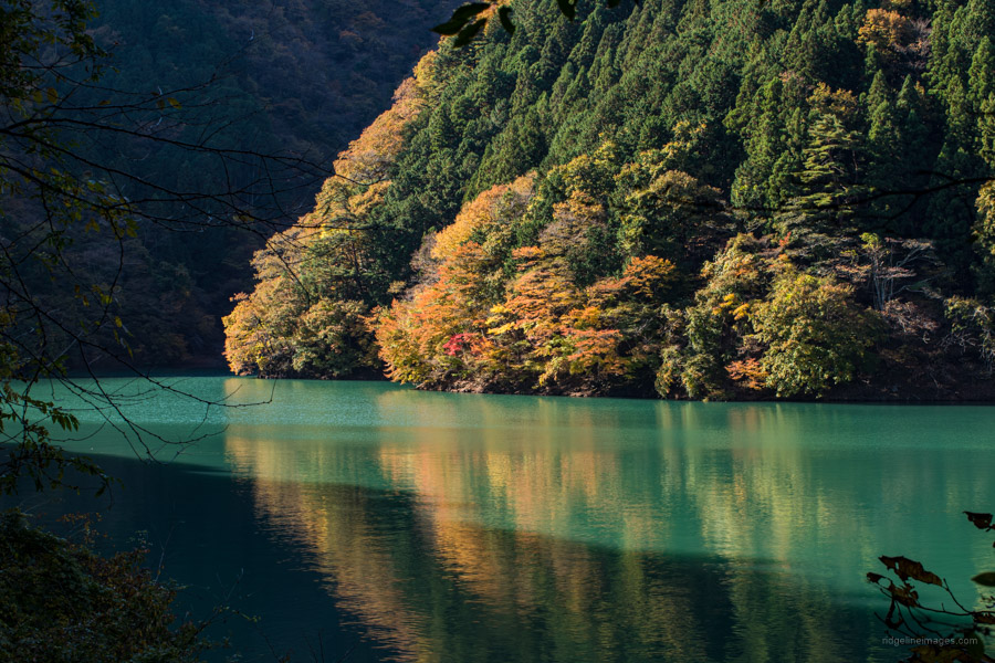


When done in November (leaf colour), I think this course is probably the most beautiful flat walk near Tokyo. It goes under the radar : not mentioned in any book or blog I know of (I found it a few years back by accident while studying the Okutama hiking map for tourists. I did this starting at Miyama Bridge (vending machines here to pick up water).The first section on road is shitty due to high speed bikes and sports convertibles, but once you hit the lakeside trail, it gets progressively more beautiful. Finishing at the dam means you can change your sweaty base layer in the large toilets. There’s a big restaurant on the 2nd floor of a nearby building. On weekends, buses back to the station run mostly every hour, so if you must wait, there are many tables lakeside to enjoy the relaxing view. Finally, this lake is bear territory, so avoid the walk in summer when they are most active; November encounters are extremely rare.
The hike much was much better than I had expected so it’s a bit of a surprise more people haven’t blogged about it. The course is marked on the Yama to Kogen map but it doesn’t include a 1:25,000 scale map of the lake area which would help draw attention to it. There was a sign mentioning a bear sighting back in the summer but like most hiking trails close to Tokyo it’s highly unlikely you’d come across one.
Bears, lakes and marshes : I’ll only text on this once, so as not to worry people unnecessarily. I plan on doing Nikko Shirane (2578m) next year. Nikko Yumoto Visitor Center website (great resource on these animals) : click on the orange bar. No English information, but you can see how many sightings per month (check July and August !), and from the map, where they cluster (mainly west and east lakeside of Chuzenji, and the marsh). Very useful planning tool — I think I’ll go in May when it’s warmed up a bit.
Lake Okutama north to Kumotori and Takanosu has several intersecting bear corridors.
http://www.nikkoyumoto-vc.com/english/nature/kuma.html
I was there two weeks ago, lots of what I think was bear spoor on the trail.
(basic) Okutama area bear sightings here: https://www.ces-net.jp/okutamavc/info/559
Also, the floating bridge is back open: https://twitter.com/okutamavc/status/1328509222003253249
Appreciate the link to the bear sightings. Good to hear the floating bridge is now accessible and would be nice if the TPTB updated their website to reflect this!
Okutama : roughly the same summer incidence rate of bear sightings as Nikko; I bet the
Ozu marsh is similar. December is the start of Asiatic black bear hibernation; a good time to hike these areas before the snows.
Thanks to this article, I did this hike today.
I started from Miyama bridge and ended at Ogouchi dam. It was kinda nice, but the middle part felt like a bit of a slog. The part between Miyama bridge and Ogouchi shrine was not good at all, since you have to walk on the road with speeding bikes whizzing by. It might be better to start/stop the hike at the Ogouchi shrine bus stop. The food at Yamo no furusato mura was not half bad. The trails were not too crowded, but the bus was quite crowded, so better start early!
As Tim mentioned above the floating bridge is thankfully back in action. Like yourself walking along the Okutama Shuyu Doro with all the Steve McQueen wannabes flying past makes you want to get off it as quickly as possible. Good to hear the trails weren’t too crowded which must have been nice.
Thanks for this! Did this hike starting at Oguchi jinja and extending on the Mukashi Michi to Okutama station. Maybe it was due to the fact that it was a weekday, but there was no one on the trail, and besides the aforementioned motorcycle sounds, it was very chill.
I walked it on 21 May 2023 and started at the Ogouchi Dam. They are redoing one part of trail about 2K into hike and they have install temp stairs to by pass the construction and you have you go down to bottom and then up the other side which was probably the hardest part of the hike. The rest of the hike is fairly flat to Furusato Mountain Village (around 12K). They have a big rest stop about half way there (around 6K) with toilet, water tank, couple of benches and picnic tables. Its a real nice place to eat lunch or take a break. There are also several benches on the trail for rest stops. I saw six people the whole time and one hard core dude was running the trail and he turn around at Furusato Mountain Village and ran past me again. I was going to go to Ogouchi Shrine and take bus back to parking near dam but the float bridge was closed, I then had to hike about 3K on a regular road with no side walk to get to a different bus stop. Be very careful if you go that way because all the speedsters were out on a Sunday. Cars were not a problem its the motorcycles you got to watch out for since I almost got hit by a couple of them. I didn’t see any bears but a few lizards, a snake and a squirrel but I would be more worried about the falling objects than bears. I saw many rocks (some the size of a melon) and branches on the trail that look like they hadn’t been there long. It was a very enjoyable hike except for last 3K of it.
It sucks when the floating bridge is out, and you have to chance it with all those Mick Doohan wannabes. You can check the current status of the floating bridge here: 奥多摩ビジターセンター #麦山の浮橋
Thank you for the write-up. I did a short out-and-back section of this starting at the dam a few weeks ago. It was very pleasant despite the hot weather. Are there any opportunities for wild camping along the trail?
Unfortunately, the area falls within the Tokyo Bureau of Waterworks catchment, so no wild camping is allowed. You can camp nearby at the Furusato Mountain Village and Yamano-Furusatomura Campground, however.