Beautiful Postcards Recall Lake Okutama’s Early Years During the second half of the Showa Period from the 1950s onwards Japan experienced remarkable economic growth with significant investment in large-scale infrastructure. In the Kanto...
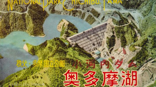
Beautiful Postcards Recall Lake Okutama’s Early Years During the second half of the Showa Period from the 1950s onwards Japan experienced remarkable economic growth with significant investment in large-scale infrastructure. In the Kanto...
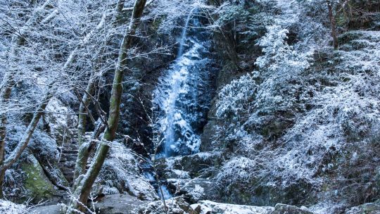
Hossawa Falls on a Wintry Morning During a previous visit to the Hossawa Falls in early spring a few years back, splendid greenery complemented Tokyo’s most renowned waterfall. This time was a little less joyful, arising at the crack of dawn on a...
What’s in a Name: Daisen vs. Oyama Reading the correct kanji for a particular mountain or any uncommon place name for that matter would arguably be the most challenging aspect of the Japanese language. Most kanji have at least two readings:...
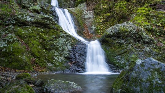
Okutama at its Finest: Mitsugama Falls In short, there are few more beautiful places in Okutama than the Unasawa Valley. The main drawcard are three waterfalls which snake their way along the Unasawa Creek downhill of Mount Odake. The hiking course...
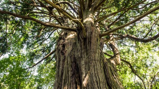
The Biggest Cypress Tree in Tokyo This remarkable tree in Okutama on the outskirts of Tokyo traces its ancestry back to the Muromachi era around 600 years ago, though some have estimated its age closer to 1,000 years. Either way the Kurasawa...
The Source of Japan’s Longest River All great rivers need to start from somewhere and Japan’s longest – the 367 km (228 mi) long Shinano River is no exception. The difficulty arises however when trying to pinpoint the actual source of a river...
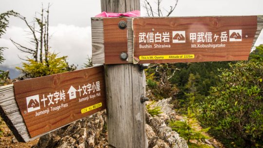
Hiked on Oct 2, 2016 Jul 15, 2020 . Moukidaira 毛木平 – Mt. Kobushi 甲武信ヶ岳 – Jumonjitouge Pass 十文字峠 Duration: 3 days Distance: 24 km Elevation change: 1173 metres Highest point: 2475 metres ...
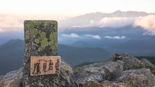
Hiked on Jul 19, 2016 . Dainichi-goya 大日小屋 – Takamiiwa Rock 鷹見岩 Duration: 2 days Distance: 7.3 km Elevation change: 572 metres Highest point: 2092 metres Start: Mizugaki-sansou Finish: Mizugaki-sansou...
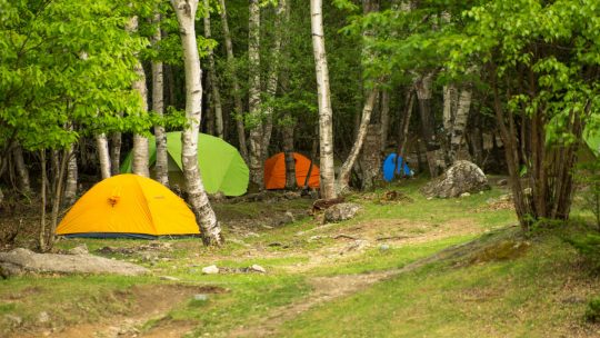
A Tranquil Campsite at the Foothills of Mount Kinpu As far as relaxing campsites go, Mawarime-daira in Kawakami Village, Nagano Prefecture is hard to surpass. Last week, I had the good fortune of returning to the sprawling grounds where I camped a...
Hiked on May 20, 2016 Aug 24, 2023 . Kurotake 黒岳 – Shirayanomaru 白谷丸 Duration: 2 days Distance: 19.8 km Elevation change: 1247 metres Highest point: 1987 metres Start: Hamaiba Mae Bus Stop ...