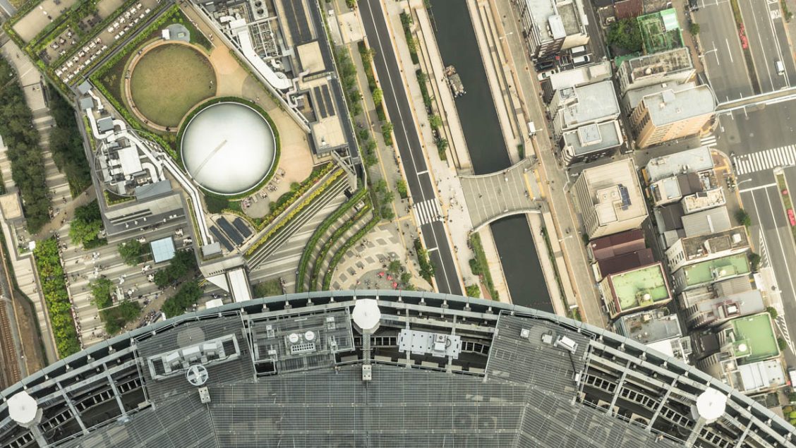
Tokyo a City of Extremes
With near on 14 million people living in the Tokyo Metropolis it goes without saying there isn’t much in the way of personal space. The corollary to this craziness is excellent food, shopping, nightlife and entertainment that Tokyo has in abundance. Venture a little further afield to the Nishi-Tama District in Western Tokyo and the contrast is stark. Not only is it mountainous with loads of nature but the population in most small towns are a shadow of what they once were. Under its care Tokyo also has over a hundred outlying islands which make up the Izu Islands and it’s even responsible for Japan’s eastern and southern most points almost 2,000 km from the mainland. It’s within these vast extremes we have drawn together a superlative showcase of all that is tall, high, deep, big, long, large and small in this wonderfully eclectic city.
.
Tallest structure
For 54 years the Tokyo Tower was the crowning glory on the Tokyo skyline until 2012 when it was upstaged by the soaring Tokyo Skytree at 634 metres (2,080 ft). The figures 6 (mu), 3 (sa), 4 (shi) spell out “Musashi” for the district Musashi Province an old name of the region where the Tokyo Skytree stands. The broadcasting tower is also painted its own colour “Skytree white” a colour based on aijiro the lightest shade of traditional indigo blue. Like many department stores and buildings held by railway companies in Japan the Tokyo Skytree is owned by Tobu Railway Corporation.
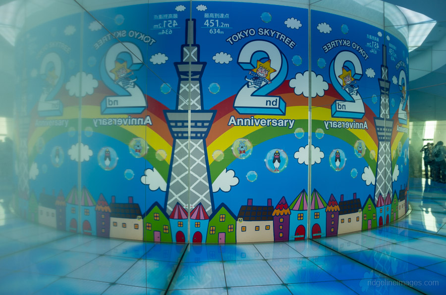
Tokyo Skytree 2nd Anniversary.
Smallest inhabited island
The Izu Islands are a series of volcanic islands south of Tokyo and administered by the Tokyo Metropolitan Government. Of the more than 100 islands which make up the Izu Island chain just nine are inhabited with the diminutive Toshima Island at 4.12 sq km (1.59 sq mi) being the smallest. The 340 residents who eke out a living on this cone shaped island rely on fishing, small scale farming and the odd tourist dropping by for their survival. About 80 percent of the island is covered in camellia forest and not surprisingly it boasts the country’s largest production of camellia oil. The island with smallest population its Aogashima with 175 locals though size wise it’s slightly larger than Toshima.
![]()
Toshima Island Izu Island chain. Image: Toshima Village.
Largest park
Once home to a Japanese military airbase, Showa Memorial Park opened in 1983 as a space for recreation and a place to get back in touch with nature. The park is in Tachikawa and Akishima around 45 minutes from central Tokyo by train. It was built in commemoration of the 50th anniversary of the Showa Emperor, who reigned from 1926 to 1989. At 165 hectares Showa Park is not only the largest in Tokyo but also the largest park of its kind in Japan. Along with formally laid out gardens there are large expanses of open lawns and getting around the park is aided with a 11 km bike path.
![]()
Showa Memorial Park in Tachikawa and Akishima.
Easternmost territory
If you think the Ogasawara Islands are far from Tokyo which they are as it takes 26 hours by large passenger ship spare a thought for those travelling to Minami-Tori-shima “Southern Bird Island” as it’s the same distance again! Also known as Marcus Island this extremely isolated triangular shaped coral atoll is some 1,848 km (1,148 mi) southeast of Tokyo though its saving grace is its airport. Along with being the easternmost territory belonging to Japan it remains under the control of the Tokyo Metropolitan Government through the Ogasawara Village. The island is off-limits to civilians and is used for weather observation where it enjoys the highest average temperature in Japan at 25.6 degrees.
![]()
Minami-Tori-shima in the northwestern Pacific Ocean. Image: YouTube images.
Biggest cypress tree
With a trunk circumference of 6.3 metres and a height of 34 metres the Kurasawa Japanese Cypress makes a striking first impression. Along with its sizeable frame the tree has been conservatively estimated to be around 600 years though could be as old as 1,000 years. The Kurasawa Cypress is located nearby the Kurasawa Bridge and was designated a natural monument by the Tokyo Metropolitan Government in 1987.
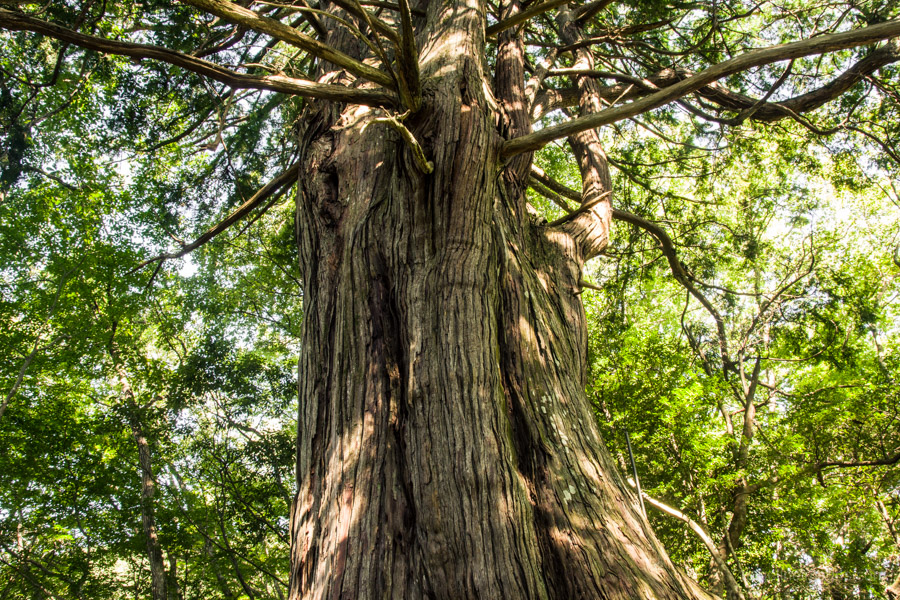
Kurasawa Japanese Cypress in Okutama.
Highest waterfall
The Hossawa Falls is four-step 62 metre (203 ft) waterfall in the picturesque Hinohara Village. The waterfall was selected as one of the 100 Waterfalls of Japan, the only one from Tokyo. During the winter the locals hold an annual “icefall quiz” where participants try to predict the day of the year the waterfall will freeze the most. The nice thing about this waterfall is it’s an easy 15-minute walk from the nearest bus stop.
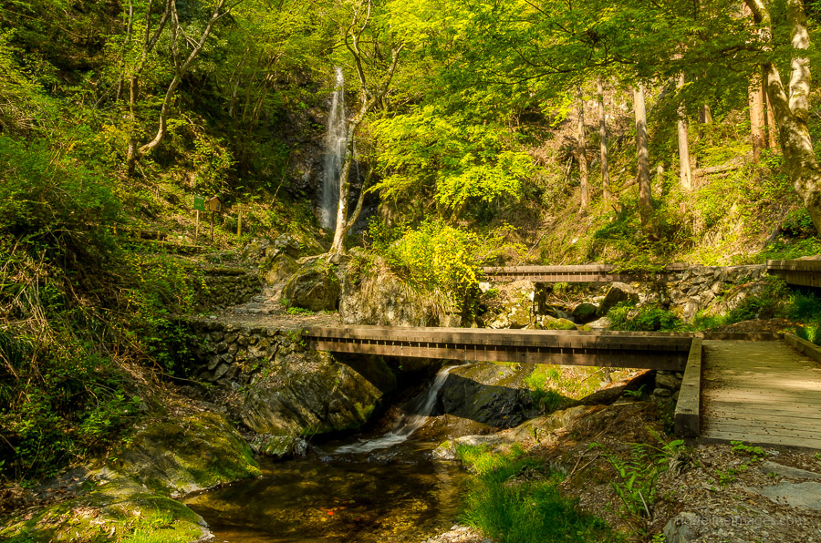
Hossawa Falls in Hinohara Village.
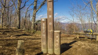
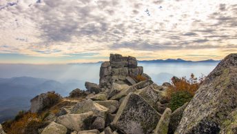
Highest point
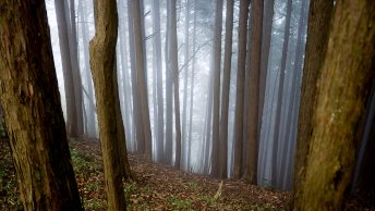
While most of suburban Tokyo sits on the Kanto Plain the Tama region of Tokyo is rather mountainous. At the very corner of the metropolis rises Mount Kumotori at 2,017 m (6,617 ft). Getting to the top is a worthy achievement and usually requires either camping out or staying overnight at a mountain hut. Standing on the summit feels like the antithesis of Tokyo that being quiet and tranquil which shows just how geographically diverse the city really is.
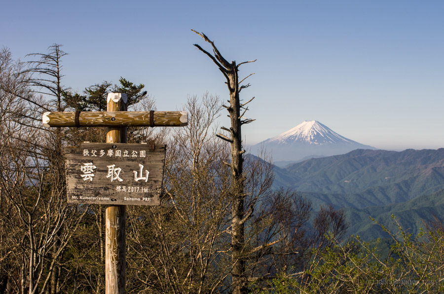
Mount Kumotori summit.
Southernmost territory
Not content with just one extreme geographic point Tokyo Prefecture also bags Okino-tori-shima “Okinotori Islands” the southernmost point. This uninhabited atoll in the Philippine Sea is likewise nowhere near Tokyo at 1,740 km (1,080 mi) to the south. In fact, Okino-tori-shima is so far south, it sits in the tropics around the same latitude as Hanoi. The three islets which make up the atoll are tiny around 60 metres in size and bolstered with concrete embankments. Strategically the atoll provides Japan with a 370.4 km (200 mi.) exclusive economic zone. In a similar vein to Minami-Tori-shima it’s administered through the Ogasawara Village.
![]()
Okino-tori-shima in the Philippine Sea. Image: Wikimedia.
Highest bridge
Nestled in the mountains of Okutama in Western Tokyo finds the unassuming Kurasawa Bridge (Kurasawabashi) which claims the title of Tokyo’s highest bridge at 61 metres (200 ft). This is no average feat as not only does it compete against the likes of the Tokyo Gate Bridge and Rainbow Bridge but it surpases all 1203 bridges in the metropolis. This truss bridge was completed in 1959 and is just a short stroll down the road from the Kawasawa Japanese Cypress.
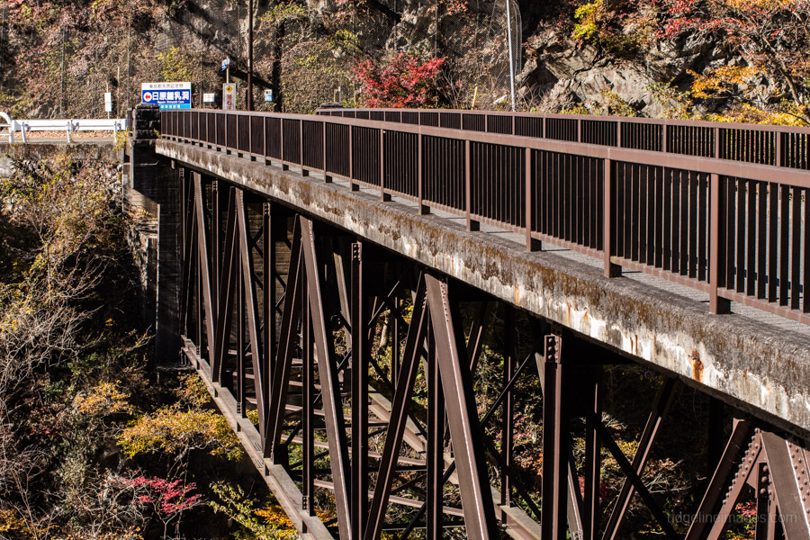
Kurasawa Bridge Kurasawabashi in Okutama.
Deepest railway station
In the heart of the Roppongi entertainment district finds the city’s deepest subway station, namely Roppongi Station on the Toei Oedo Line. The subway station rests at a respectable 42.3 metres (138 ft) underground or the equivalent 7 floors down which means racing down to meet the last train isn’t a lot of fun. Everyday 100,000 commuters use Roppongi Station each taking on average 3 minutes of trudging to reach surface. The distinction of the deepest station in Japan goes to Doai Station at 70 metres (230 ft) underground on the Joetsu Line in Minakami, Gunma Prefecture, here you won’t find any escalators just 486 steps from the ticket gate to the platform.
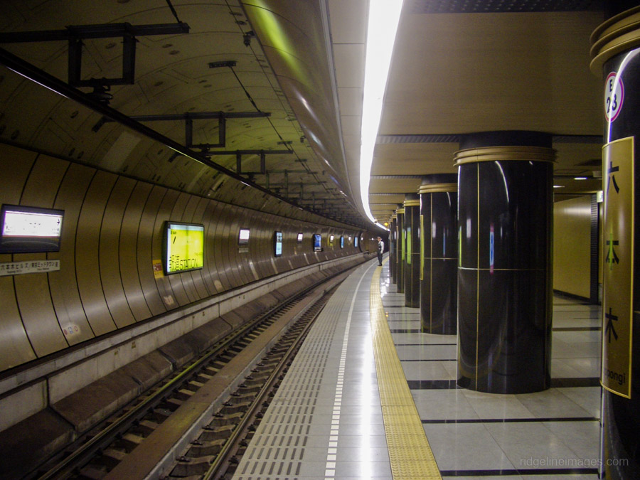
Roppongi Station Toei Oedo Line. Image: Wikimedia.
Longest cave
Tokyo probably isn’t a city that you would normally associate with caves, however Western Tokyo has rich deposits of karst limestone. At present there are three tourist caves in Tokyo with Nippara Limestone Cave being the best known. In the halcyon days of caving back in the 1980s there were six caves open to spelunkers with the longest being the Nippara Mitsumata Do at 3,220 metres (2 mi). Due to safety concerns owing to its location next to a limestone mine the cave has sadly been under lock and key for the past 30 years.
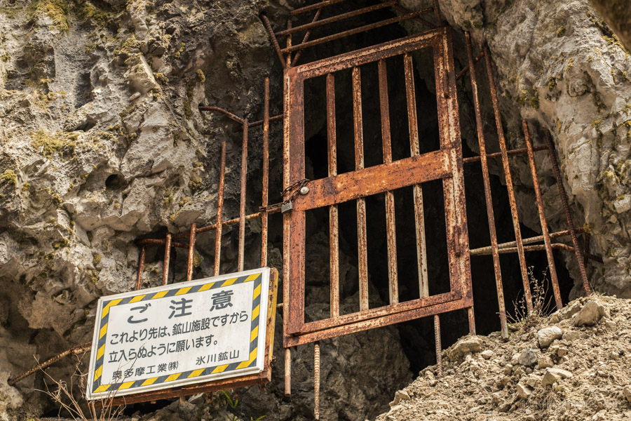
Nippara Mitsumata Do Cave.


I love the deep, dark Doai station because it is the access to my favourite Tokyo-accessible mountain in Tanigawa dake. Great hiking in all seasons, along the river or even better over the top, skipping the cable car if you dare, then traversing along the peak line and down to Tsuchitaru for the return journey. There used to be a special 7.14 weekend train out of Ueno to Minakami and then local to Doai, got you there 10ish and set up for a brilliant day. Nowadays it seems you have to shell out more for the shinkansen or spend forever in the train system.
No question, Doai Station is certainly unique. I guess they stopped that morning service as the incoming passenger numbers for Doai only average around 19 a day though presumably more on the weekend. In order to arrive at Doai by 10 am you now need to leave Ueno at 6.26 or as you say fork out for a shinkansen. One of my goals this year is traversing along the ridge from Tanigawadake to Tairappyoyama.
That is a fine looking ridge line. I once did a lovely spring solo overnighter from/to Doai by doing an anticlockwise loop north to Mt Asahi and Shimizu toge, then around the Tanigawa (the river) source watershed ridge and back over Tanigawadake. I have fond recollections of being invited to join a small Japanese group on the watershed ridge to share the sansai they had collected and cooked – a wonderful experience with memorable 360 degree views. My aim had been to try and photograph the Ichinokurasawa views from the Asahi ridge – a spectacular photo that was plastered across the drink machines in the Tokyo JR stations in that mid-90s period advertising Oshimizu bottled water.
Those southern islands – all within the city limits – really capture the imagination. Time for a series on them, perhaps?
The mind boggles to think that these islands call Tokyo home. I guess their upkeep requires deep pockets which is probably enough for closer prefectures to give them a wide berth. A follow up series is a nice idea.