.
Mt. Hodosan 宝登山
Distance: 6.2 km
Elevation change: 347 metres
Highest point: 497 metres
Start: Nagatoro Station (Chichibu Main Line)
Finish: Nagatoro Station (Chichibu Main Line)
Difficulty: ▅▅▅▅▅▅▅▅▅▅ ❶
Map: Yama to Kogen Chizu 山と高原地図 [No.23 奥武蔵・秩父 OKUMUSASHI·CHICHIBU]
GPX TrackKML TrackGSI MAPPDF Topo Map
Family Friendly Hike in Nagataro, Saitama
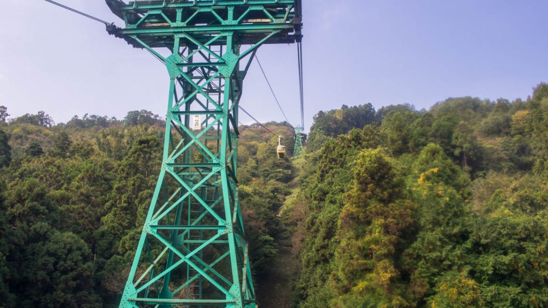
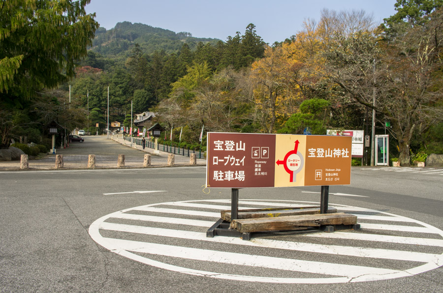
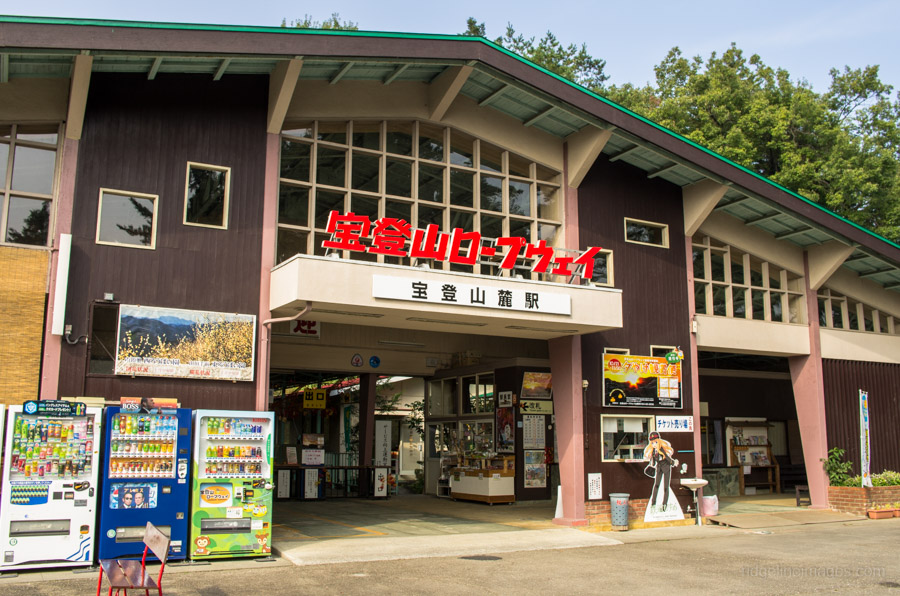
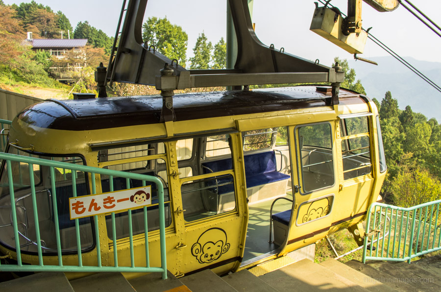
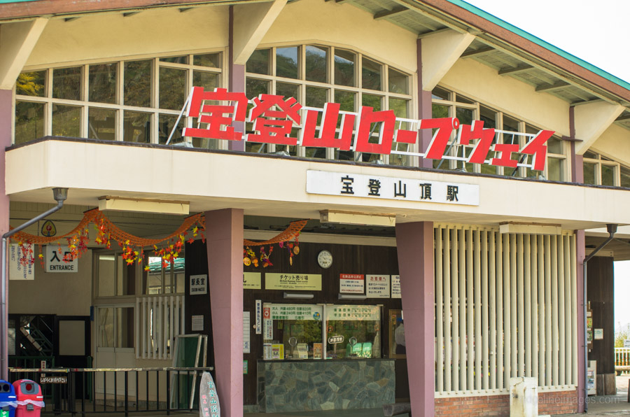
Nagatoro, along with Iwadatami Rocks, is arguably one of the best sightseeing locales in Chichibu, Saitama Prefecture. A relaxing family-friendly hike is up nearby Mount Hodosan, which is easily accessible from Nagatoro Station along the Chichibu Main Line. From the railway station head west for 700 metres along the road heading up to the Hodosan Jinja. Look for a road veering off to the left next to the restrooms. The Hodosan Ropeway terminal building is located a little above the main car park. The Hodosan Ropeway opened in 1959 and walking through the lower terminal building shows much of the décor and amenities looking like they had escaped the passage of time. The Ropeway runs at 30-minute intervals (820 yen round-trip: Daily 09:40-16:30) and hitching a lift up on clear days provides a picturesque backdrop of the Arakawa River and nearby Mount Buko.
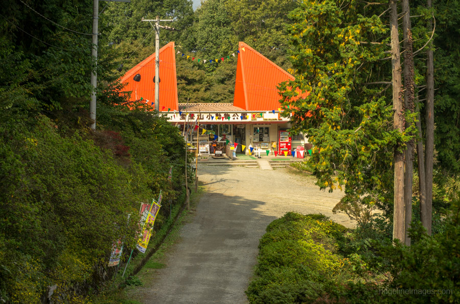
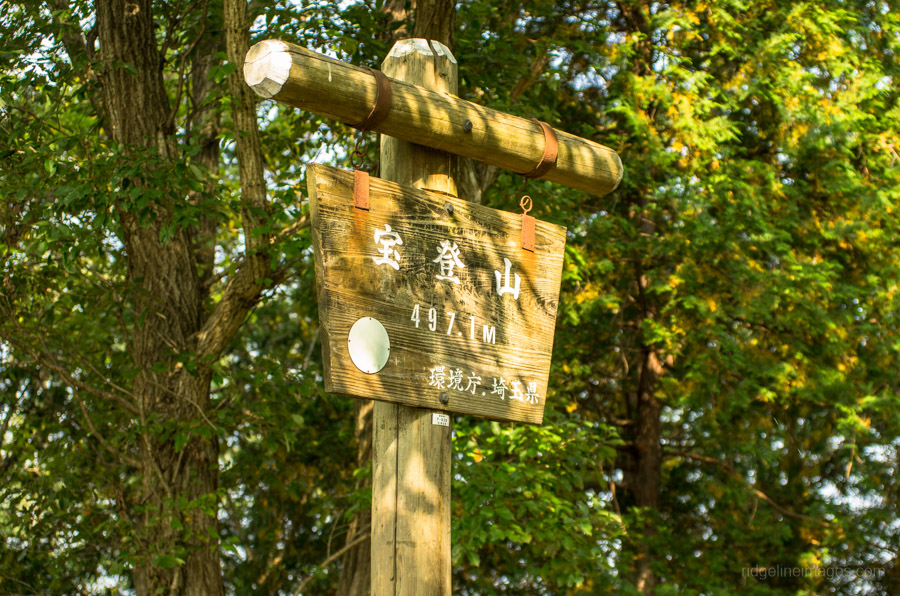
From the upper terminal building, it’s a leisurely 10-minute walk to the summit of Mount Hodosan 宝登山 (497 m). In late January to mid-February, the fragrant yellow flowers of the Robai or wintersweet, trees bloom, and similarly in autumn, it’s a popular place to watch the changing Fall colours. While the summit of Mt. Hodosan is hemmed in with tree cover, the upper ropeway station provides good views of the surrounding mountain ranges. When you’re ready to head off, head down the stairs below the upper shrine and turn left and right again before the Small Animal Zoo. The overhead ropeway passes at a couple of points along the access road, allowing for some snapshots of the approaching cable cars.


Thanks for the great & free info. You are truly providing an awesome service.
I was hoping to ask whether you have a post dedicated solely to family friendly hikes. Much appreciated!
Noah
Thanks for that Noah, it’s really nice of you to say so 🙂 Currently, I don’t have a post focused solely on family friendly hikes which is not to say it hasn’t crossed my mind. Stay tuned and I will endeavor to put something together in the coming months.
Hi David, This looks great and the station looks charming as well.
We are going to try this on Friday, Aug 5th. i wanted to clarify, your route takes the ropeway up? And does the 6.2 km include the ropeway part or is it 6.2km hiking? And similarly is the ascent how much inclusive of the ropeway (so not much hiking up)? Thanks.
Hi Jackie, yes, I took the ropeway up. The route includes the ropeway so in real terms the hike is around 5.5 km. Given that much of the ascent uses the ropeway there isn’t much hiking up and probably less than 100 metres in total from the station. Hopefully the mosquitoes don’t bother you too much this time ?