.
Hinodeyamakita Ridge 日ノ出山北尾根 – Mt. Hinodeyama 日の出山 – Mt. Mitsumuroyama 三室山
Distance: 11 km
Elevation change: 652 metres
Highest point: 902 metres
Start: Mitake Station (Ome Line)
Finish: Hinatawada Station (Ome Line)
Difficulty: ▅▅▅▅▅▅▅▅▅▅ ❸
Map: Yama to Kogen Chizu 山と高原地図 [No.25 奥多摩 OKUTAMA]
GPX TrackKML TrackGSI MAPPDF Topo Map
The Forbidden Ridge: An Unconventional Approach to Mt. Hinodeyama
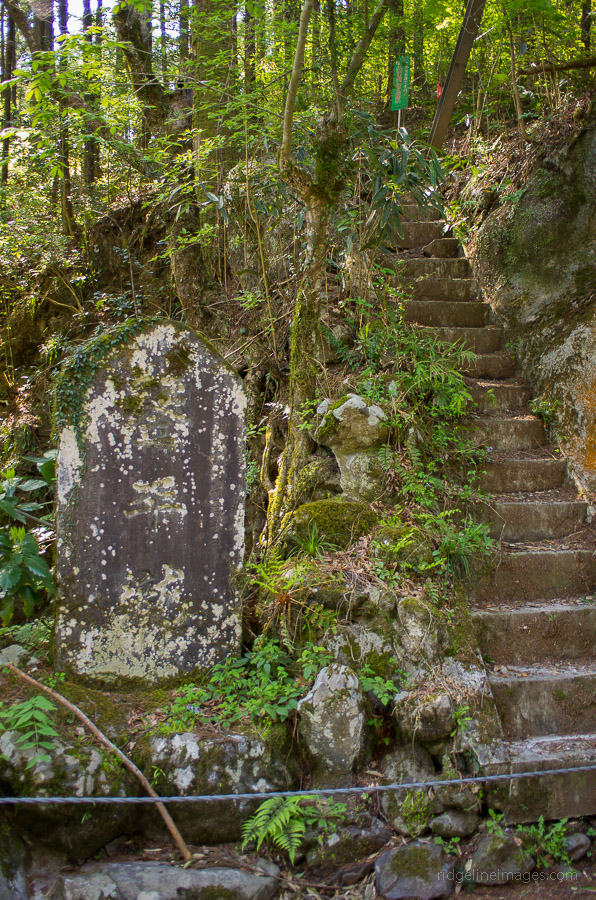
Firstly, a disclaimer: the hike described below is not one I necessarily advocate, as you will likely receive little sympathy if something goes amiss. Having said that, this particular ridge traverse to Mt. Hinodeyama 日の出山 is notable for two reasons: first, it’s rather steep, and second, as you may have guessed, it’s officially off-limits to hikers. The trail entrance at both ends is reasonably well concealed as I found on my first hike to Mt. Hinodeyama earlier this year. With no discernible trail visible from the summit, I begrudgingly returned via the Mitake Tozan Cable. Doing a little investigation I found the trailhead on the Mitake Station side was probably a better alternative which I managed to locate during a later recon in early spring click here. On that occasion, while climbing up the incongruous-looking stone stairs to the trailhead, my girlfriend and I were accosted by a nosey local who began berating us about the impending danger that lay ahead and the trouble that would likely ensue if we continued. It was like a re-enactment from the horror-comedy film, An American Werewolf in London, where the two backpackers were advised to “Stay on the road. Keep clear of the moors”. From this point, I started to figure there must be more to the story.
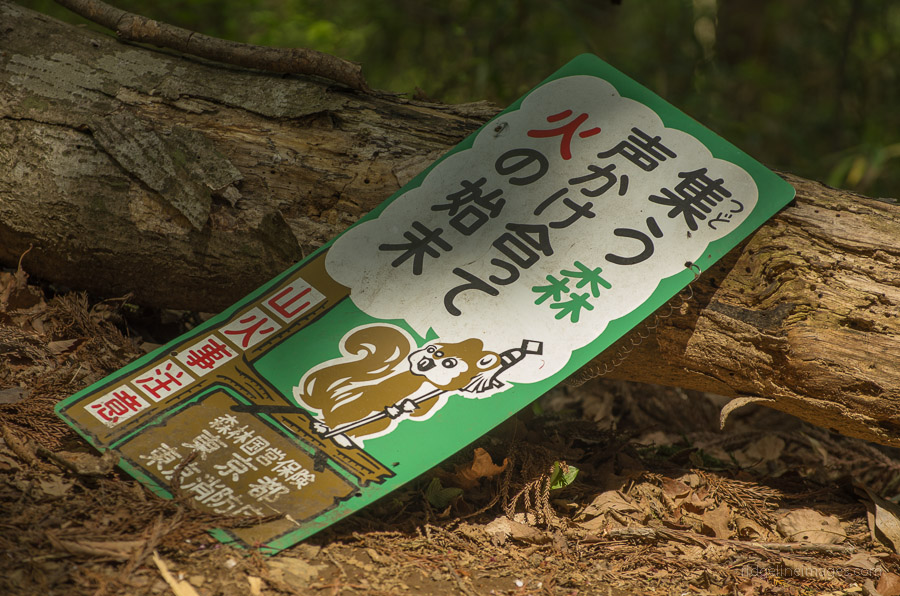
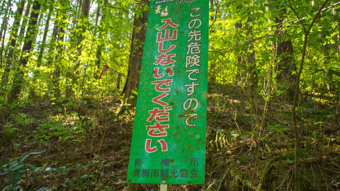
The Hinodeyamakita Ridge trail is not surprisingly absent from most hiking maps, including Shobunsha’s Okutama 1:50,000 and the official government 1:25,000 topographic map series. The only evidence of its existence comes from the Okutama Nature Information Map published in 2008, where it is shown as a minor pathway. Visible at the start of the trail is a sign mounted courtesy of the Ome City Tourist Association stating: Please don’t enter the mountain trail as it is dangerous. This has led to various conspiracy theories, including suggestions that the Mitake Tozan Railway does not want people hiking directly to the summit, thereby bypassing their monopoly on ferrying passengers. On further research, it is likely the hike crosses private property leased by a landowner, and the owner doesn’t want large crowds of daytrippers trespassing, which is fair enough. Another point is that, while the hike is by no means dangerous, the trail is rather rough and steep, which is unusual for one so close to a popular tourist destination.
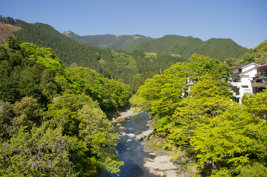
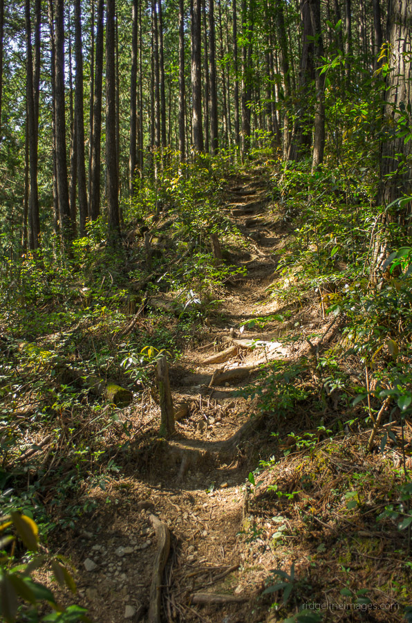
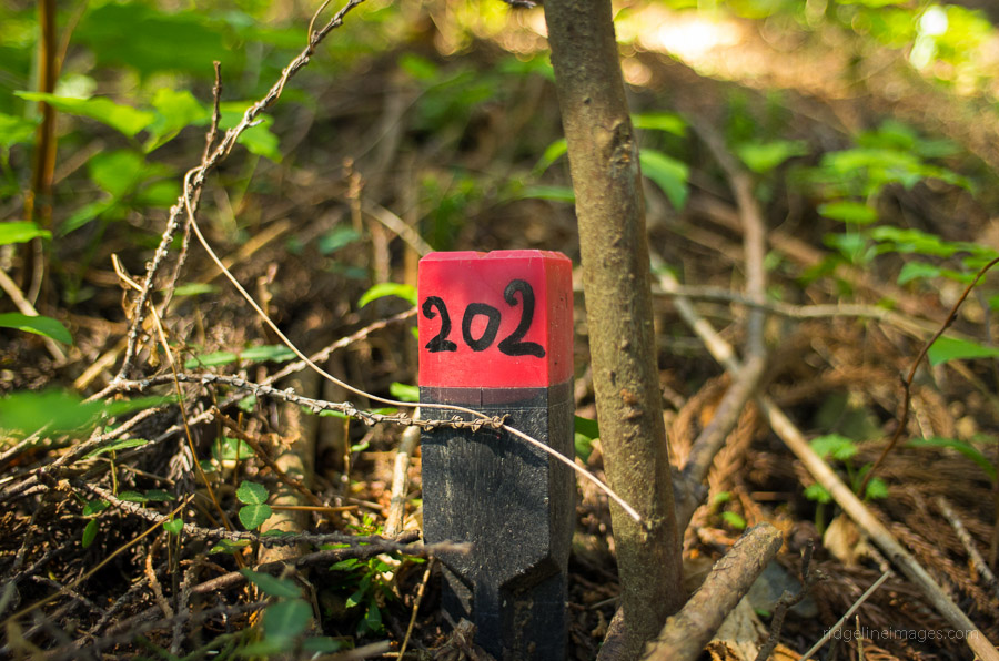
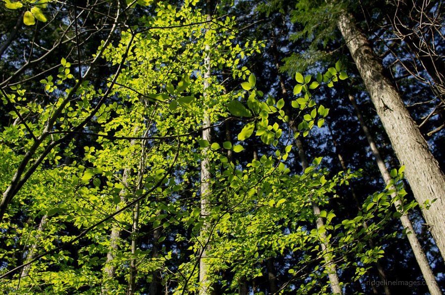
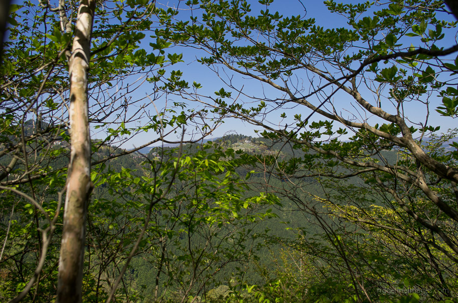
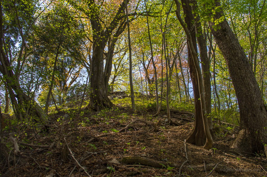
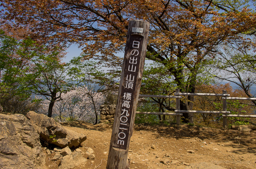
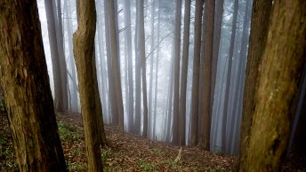
So with a firm understanding of what I was up against and the Golden Week weather turning on some of its finest, I decided to take the plunge. Typical for this time of year is the ghastly number of hikers packed into the Okutama train carriages, akin to commuter rush hour. Existing Mitake Station 御岳駅 most punters made a beeline to the nearby buses waiting to shuttle them to the cable car, leaving only a couple of us making the journey on foot. The walk to the Kousenbashi Bridge 光仙橋 which marks the start of the trail, takes around 20 minutes. Straddling the steep staircase while trying to evade detection brings you to the start of the Hinodeyamakita Ridge 日ノ出山北尾根. While the route is devoid of the usual signposts, it is actually well-marked with tape wrapped around trees and a series of numbered red markers tacked close to the ground. The walk from Mitake Station to the summit of Mt. Hinodeyama 日の出山 (902 m) takes around two hours. There are a couple of prominent rest stops, including one marked on the map as 露岩 exposed rocks. About halfway up there are some fine views offered to the north overlooking Mitake Township. During the final ascent, the trail dips into a saddle where the summit viewing platform finally comes into view.
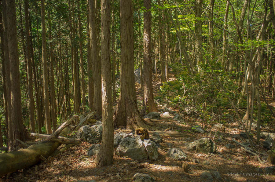
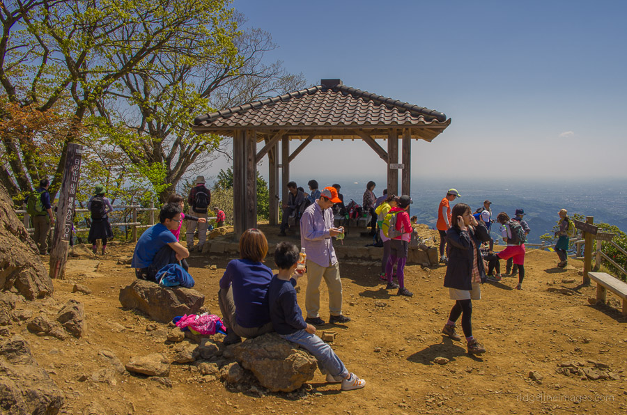
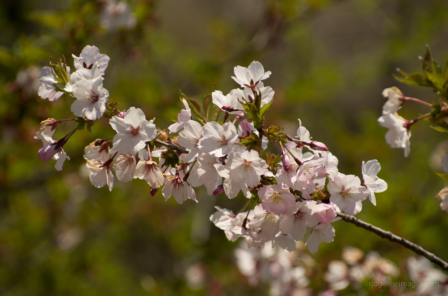
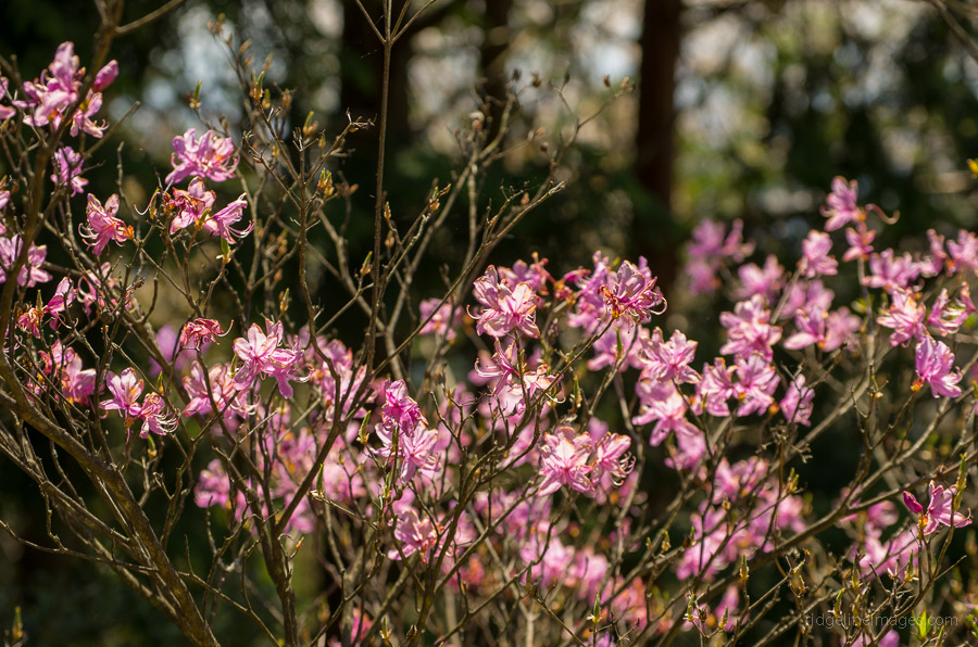
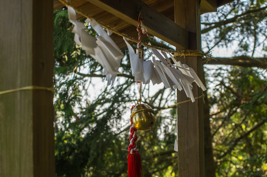
Arriving at Mt. Hinodeyama unscathed, I was greeted by an overwhelming number of fellow hikers who had no doubt arrived by less devious means. The view by mid-morning was becoming somewhat hazy, though the spring flowers, including some late-blooming cherry blossoms, livened the backdrop. Perusing the map, I decided the best route back to civilisation was via Mt. Mitsumuroyama 三室山 (646 m) and the small Imunokonpira Shrine 厳の金比羅神社 onwards towards Hinatawada Station 日向和田駅. The trail back, in comparison, was like a highway firmly trodden into the landscape. I quickly lost count of the number of hikers I passed in both directions, distracted by the incessant clamour resonating from bear bells – the joys of Golden Week hiking. Surprisingly, I also met a fair number of mountain bikers who somehow managed to crawl through the masses.
The last section of the trail twists through a shaded valley before finally coming to an abrupt end where it meets the bitumen. From here, follow the road through the village, making a left turn at the first set of traffic lights and a right at the next. The railway station is located another 700 metres across the Tama River to your right.